

+6017 945 3992
See every site. Know every detail.
OpenSpace
OpenSpace transforms your construction site into a living visual record. Capture every walkthrough automatically, compare progress against BIM, and make faster decisions with AI-powered insights — all from one intuitive platform.


What is OpenSpace?
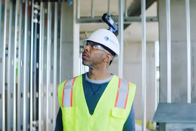
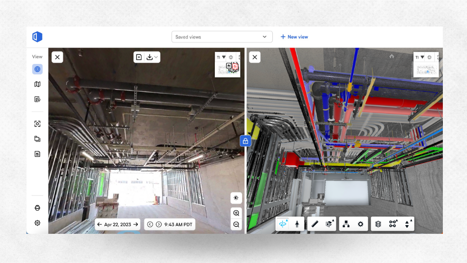
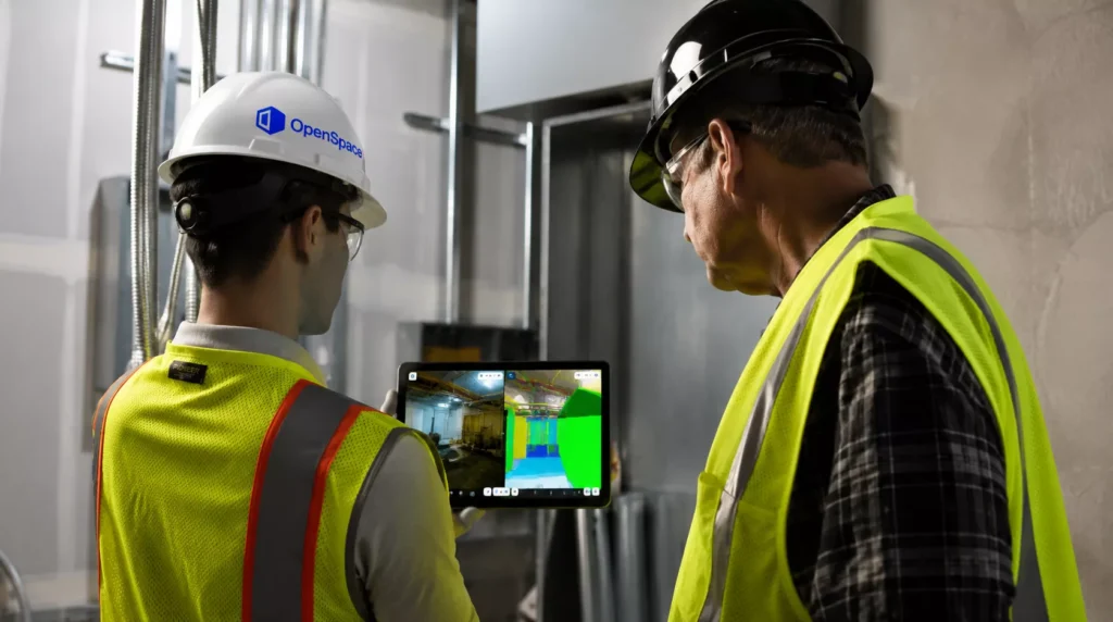
OpenSpace is an AI-powered visual documentation and analysis platform designed for the construction industry to track jobsite progress. By attaching a 360-degree camera to a worker's hard hat, the software automatically captures and maps video imagery onto the project’s 2D floor plans, essentially creating a "Google Street View" timeline of the construction site. This allows remote stakeholders, project managers, and builders to virtually walk the site, compare actual progress side-by-side with 3D building models (BIM), document issues, and resolve field conflicts quickly without needing to be physically present.
How OpenSpace Delivers Valuable Project Data
Instead of relying on photos, notes, and memory, OpenSpace automatically captures your jobsite as you walk. Every image is mapped to your floor plan, creating a searchable visual history that everyone can access anytime.

Use case in a construction team setting
Project Managers
Track progress without being onsite.
Architects
Verify installations against design intent.
Consultants
Review construction remotely with confidence.
Owners
Stay informed with real-time visual updates.
Benefit of using OpenSpace?
Saves Time
Reduce manual site documentation and reporting.
Improve Team Collaboration
Give every stakeholder instant access to the latest site conditions.
Reduce Rework & Cost
Identify issues earlier before they impact cost and schedule.
Make Faster Decisions
Access visual evidence anytime, from anywhere.
How OpenSpace Works?
Every walkthrough creates a permanent visual timeline of your project.
Need to confirm what was installed three months ago? Simply rewind and revisit any captured location within seconds.
Full product suit of OpenSpace
The full OpenSpace product suite, available through BIMAGE Consulting.
OpenSpace Capture
Automatically document your project using 360° cameras or smartphones.
OpenSpace BIM+
Compare BIM models directly with site reality using intuitive 3D visualisation.
OpenSpace Track
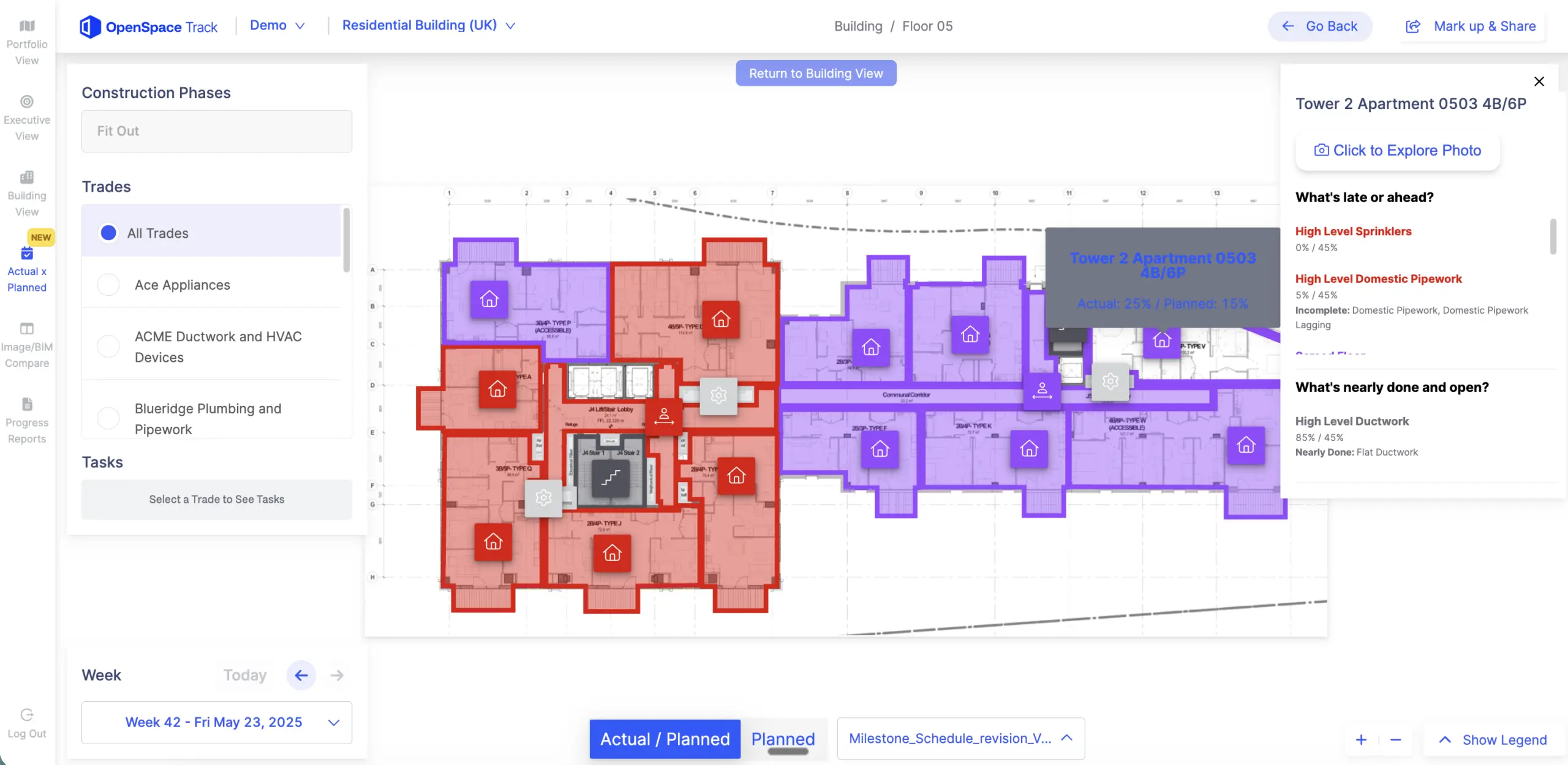
Monitor project progress with AI-powered tracking and reporting.
OpenSpace Field
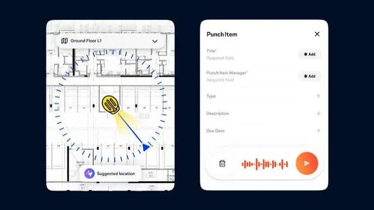
Create image-based tasks and collaborate directly from captured site imagery.

OpenSpace Air
Combine drone imagery with ground captures for complete project visibility.
Interested in OpenSpace?
Contact our customer support by clicking on the button below. Our team will get in touch with you very soon.

Let Us Help You Find The Right Solution!
Talk to one of our professional consultants now and we'll see how we can help you simplify your project with better productivity, cost-saving and high quality design.

BIMAGE Consulting is a technology base company who is specialised in the implementation of IR4.0 and digital transformation for the steel and construction industry. We are an authorised reseller for Autodesk, Matterport, Water Infrastructure Solutions (Innovyze), INFR (VR Collab), ESRI Malaysia, Airsquire and Fuzor software.


We are proud to be ISO 9001 certified and recognized as a Malaysia Digital Status company under Malaysia Digital Economy Corporation (MDEC).
Info
+6017 945 3992
Selangor
C-7-4, Block C, Setiawalk, Persiaran Wawasan,Pusat Bandar Puchong,47160, Puchong, Selangor, Malaysia.
Pulau Pinang
Room D, No. 25, Jalan Chain Ferry, Taman Chai Leng, 13700, Perai, Pulau Pinang
Copyright © 2026. BIMAGE Consulting Sdn Bhd (1323296-H). All Rights Reserved
